Maps
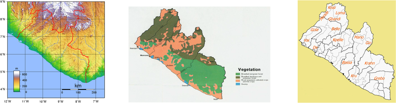
Liberia lies on the North Atlantic coast of Africa. It has diverse regions from coastlines and flat lands to rainforests to the south. Topography of Liberia (right) is predominantly flat, with its highest point at the top of Mount Wuteve, 1380 meters above sea level.
(Middle)Liberia has year-round evergreen vegetation. Many trees—such as red ironwood, camwood, whismore, teak, and mahogany, rubber, cacao, coffee, and the raffia palm.
(left)Officially There are 16 ethnic groups that make up Liberia's indigenous African population, making up about 95% of the total population (left)
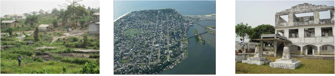
Liberians have effected their country in many ways. There’s evidence of human impact in Liberia. From the rural homes spread out in much of Northern Liberia to the bustling capital city. Civil war has destroyed countless homes, and left former towns and cities in rubble. (Left) A typical rural farming community, the majority of what is consumed is what their able to grow themselves. (Middle) An aerial view of the coastal city of Monrovia, Liberia capital which has the highest concentration of people in the country. (Right) The former residence of former Liberian President. His home was left abandoned after multiple bombings during the civil war in the 1990's.
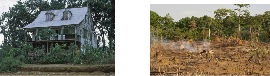
(Right) There’s evidence of the past to integrate the former Southern American slaves. Houses with pitched roofs and wrap around porches. (left) As Liberia reconstructs itself after many years of civil war deforestation has become an issue.
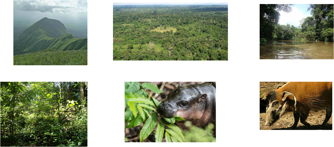
There are hosts of different kinds of natural landscapes Liberia Mount Nimba (top right) is the highest point in the country reaching 1752 meters. () The Sinoe River(top middle) is one of many rivers in Liberia that empties into the Atlantic Ocean. Liberia has the largest remaining part of the Upper Guinean forest ecosystem, with an estimated 42% of the remaining forest. Sapo National Park is known for its biodiversity, is endemic to many species. Some of the animals that the park protects are the pygmy hippo (bottom middle) and the red river hog (bottom right).
Maps cited: (in order)
Topography [ online image] Retrieved September 9, 2015 from
https://upload.wikimedia.org/wikipedia/commons/4/4b/Liberia_Topography.png
Vegetation [ online image] Retrieved September 9, 2015 from http://www.fao.org/ag/agp/agpc/doc/counprof/Liberia/liberia.htm
Tribes of Liberia [ online image] Retrieved September 18, 2015 from http://bloggingwithoutmaps.blogspot.com/2012/06/people-groups-of-liberia.html
Human Landscapes Photos cited:
Farm land: Janzen, T. (2014, March 19). Janzen Ag Law: The Challenges Facing Liberian Agriculture. Retrieved September 19, 2015, from http://www.janzenaglaw.com/2014/03/the-challenges-facing-liberian.html
Monrovia [ online image] Retrieved September 9, 2015 from http://www.ideels.uni-bremen.de/monrovia2.html
Home: (2014, March 19). Janzen Ag Law: The Challenges Facing Liberian Agriculture. Retrieved September 19, 2015, from http://www.janzenaglaw.com/2014/03/the-challenges-facing-liberian.html
Americo Liberian House: Liberia77. (1975). Retrieved September 19, 2015, from http://liberia77.com/explore/americo-liberian-house-4/
Deforestation [ online image] Retrieved September 19, 2015 from http://www.theguardian.com/global-development/2012/jul/05/liberia-forest-sell-off-risks-conflict
Natural landscapes Photos cited.
Mount Nimba [ online image] Retrieved September 19, 2015 from http://www.britannica.com/place/Mount-Nimba
Forest Sinoe River [ online image] Retrieved September 19, 2015 from http://pygmyhippofoundation.org/about/sapo-national-park/
Sapo National Park [ online image] Retrieved September 19, 2015 from http://pygmyhippofoundation.org/about/sapo-national-park/
Pygmy Hippo [ online image] Retrieved September 19, 2015 from http://www.earthtouchnews.com/cute-and-cool/zooborns/newborn-pygmy-hippo-enough-said
River Hog [ online image] Retrieved September 19, 2015 from http://www.bcxnews.org/blogs/animalblog/2011/20110125_Red_River_Hog_Los_Angeles_Zoo.jpg
